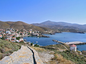
Chios Island is a Greek Island located at the East Aegean Sea, close to Turkey. Throughout history Chios played always an important role due to its strategic location.
Chios island is extremely interestic with plenty to see. The numerous beaches of Chios Island (well over 60) will satisfy even the most demanding visitor.
Make sure you have enough time to get to know this marvelous island, which is the fifth (in size) island of Greece.
Watch a video with some of the interesting places in Chios island
(unfortunately available only with Greek commendation)
Chios history
Chios town is the capital, the administrative, economic and cultural center of the island of Chios. It has a population of 30,000 and it is situated on the east coast of the island. Archaeological discoveries have shown that Chios has been inhabited continually since 6000 BC. The ancient city was built by Greeks shortly before 1000 BC.
From the ancient years until now, Chios has experienced long periods of prosperity and decline and in each rebuilding, the city has always covered about the same geographic area. For this reason, one can find evidence in the modern city from all periods of its long history.
Chios Town sightseeing:
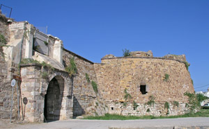
During Ancient times the city of Chios spent periods of great economic and intellectual wealth. Apart from being famous for its formidable navy and for its great commercial strength (which profoundly affected scientific and cultural growth) Chios is regarded as the birth place of the greatest poet of Ancient times Homer. Chios was undoubtedly one of the most important cities of the Greek Colonies in Ionia (Asia Minor). During the Roman Period Chios declined but in the Byzantine era recovered and for about 1000 years it became one of its most important provinces.
Chios town is the capital, the administrative, economic and cultural center of the island of Chios. It has a population of 30,000 and it is situated on the east coast of the island. Archaeological discoveries have shown that Chios has been inhabited continually since 6000 BC. The ancient city was built by Greeks shortly before 1000 BC.
From the ancient years until now, Chios has experienced long periods of prosperity and decline and in each rebuilding, the city has always covered about the same geographic area. For this reason, one can find evidence in the modern city from all periods of its long history.
In 1346 it was occupied by the Genoese. In 1566 the Ottoman Turks, having already conquered the Byzantine Empire drove out the Genoese, took Chios and occupied it until 1912. In that year Chios was liberated and became part of the rest of Greece.
The numerous remains of Chios historical past are everywhere to be witnessed and enjoyed.
The Archaeological Museum of Chios is located at Museum str, about 100m southern of the port.
The Byzantine Museum of Chios is located right at the main square of the island, called Vounaki. The building of the museum is the old Ottoman mosque.
The Giustiniani Palace is a small building right at the main entrance of the Castle of Chios. It was the house of the Genoan family of Giustiniani who ruled the island during a larg7e period of the middle ages. Now it serves as a small medieval museum.
The Chios Maritime Museum. Chios is well known for having a strong maritime presence over the years. Even now Chians are the owners of more than half of the whole Greek merchandise fleet, one of the biggest worldwide.
Koraes Library:
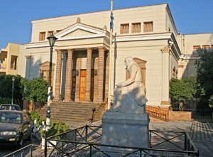
The Koraes Library & Argenti Folklore Museum is located in the same building at Koraes str. in the center of town, next to the Cathedral. It is one of the oldest and biggest Libraries in Greece, certainly a worth visiting monument. Among other things you may see the books of Adamantios Koraes, some of them given to him as a gift by the French Emperor Napoleon.
The Public Art Gallery of Chios is located at Andreas Syngros str. in the city center just a few meters away from the main Chios square, called Vounaki square.
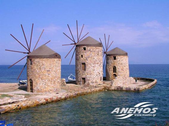
Wind Mills
You can see an example of them in the lower left part of the photo and in the photo below.
They are 1.5km from the center of town to the north (in top part of the photo you can see the main port of the town)
These wind mills were part of a small scale industrial production of Chios.
Kampos
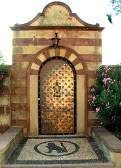
One of the most beautiful areas of the island is Kambos, a green valley 3 Km south of town covered with citrus orchards. Kambos is a flat land that stretches, along the east coast of the island of Chios, about 10 Km long and 2 Km wide.
In the 14th century, the Genoese selected this area to build their mansions, as did the local aristocrats in later years, creating a new socio-economic level. High walls made from Thymiana stone protected the mansions and the orchards from dust, winds and cold. In the past, the orchards were watered from big wells. Water was drawn by huge water wheels turned by animals.
Elaborate cisterns decorated with marble reliefs and spouts, figure centrally in the courtyards. Shady paths, gardens of flowers, and creeping vines of jasmine create a unique atmosphere.
Chios is well know for its excellent mandarins (tangerines) with their exquisite aroma. These citrus fruits maily come from the area of Kampos.
Central Chios
Karfas
is located 7 Km south of the town of Chios and is among the most well-known and loveliest beaches of Chios, with a fine golden sand, suitable for beach games and relaxed sunbathing. Ideal for children because the water is warm and the sea very shallow.
Being a tourist center, Karfas has many hotels, apartments, studios, restaurants, taverns, bars offering all the tourist facilities.
Thimiana
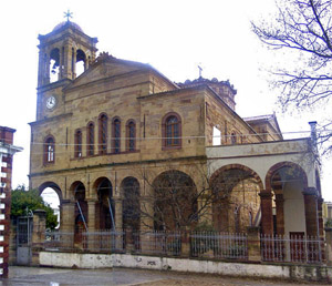
7 km to the South of the city of Chios Thimiana village is located. It is among the larger villages on the island with approximately 1600 inhabitants. The village is renowned for its many quarries from which the “Thymiana” stone was extracted in many shades of brown and red. Many mansions and churches in kampos are built with this stone.
The village of Thymiana has a primary school, sports associations, a swimming club, a cultural club as well as the large church dedicated to Aghios Efstratios, a masterpiece of local architecture, also built with the well-known Thymiana stone.
Avgonyma
On the main road of central-western Chios, after passing, karyes on our route to the west, in a distance of 16 Km from Chios town, on a rocky hill, there is the graphic village of Avgonyma with very few residents. The houses are built with local stone. During the sunset, the view of the Aegean sea and Psara island, the bay of Elinda is unique.
Anavatos
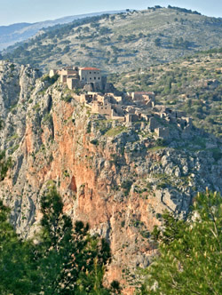
The village of Anavatos, 16 Km from town, is built on a conical cliff 450 meters above sea level, with steep sides to the south and west, and with only a single access to the north.
The people took advantage of the natural fortification of this cliff and strengthened it with a circular wall surrounding the houses that seem to be glued, one to the other. Together with the cliff, the village made up the defensive perimeter of the fortress.
The 400 houses inside the walls were narrow and built of grey stone taken from the same mountain. As a result, you can hardly distiguise the village from far away. The buildings have flat wooden roofs, low doors and tiny windows.
The village was abandoned after the slaughters of Chios by Turks in 1822 and in our days it is a National Monument for all the Chians and Greeks.
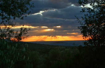
Lithi
It is situated 4 Km north of Vessa (at a distance of 23.5 Km from the town of Chios). There are three caves in the area, but not yet fully explored.
Lithi is a famous fishing village. Traditionally, the main occupation of its inhabitants has been fishing.
It is worth visiting its sandy beach for a relaxed swim in the beautiful sea. There are plenty of taverns for enjoying eating local fresh fish and seafood in general. Also there are some small hotels and rooms to let if you want to stay a few days and enjoy the sea and the fresh fish.
The sunset at Lithi is unforgettable.
Nea Moni
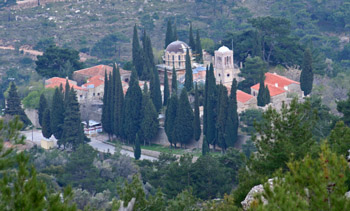
(New Monastery) is a monument of international significance. The catholicon (main church) is the most important specimen of the insular octagonal domed type of church and is lavishly decorated with marble revetments and mosaics. Nea Moni was founded in the middle of the 11th century, with a donation of the emperor Constantine IX Monomachos and his wife, Zoe.
For many centuries it was the most important religious center on Chios but was repeatedly destroyed in the 19th century.
Nea Moni was plundered by the Turks in 1822 and was severely damaged by an earthquake in 1881.
These caused the collapse of the dome, the belltower, the apse of the sanctuary of the catholicon, as well as the destruction of many mosaics. Recently has undergone restoration and preservation of the mosaics. There, is also found the very interesting Nea Moni Museum. Nea Moni is the most famous sample of medieval monasteries architecture in the whole Aegean islands.
South Chios
The land of mastic with 24 villages.
Armolia
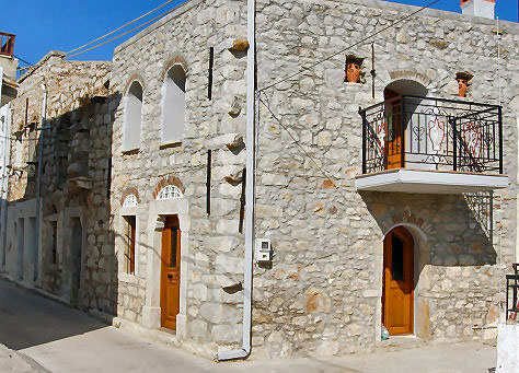
This medieval village is located 20Km SW of the city of Chios butt nowadays is almost re-built. A few remaining arches above the narrow roads in the center of the village give you an idea of its original architecture. There are still a few remains of old houses. In compensation for the changes, all the new houses have gardens full of flowers.
The habitants of Armolia have a long tradition in making and decorating ceramics such as: pitchers, vases, jars, bowls and cups so there is a marvelous collection of local ceramics, and you can still see the potters hand working with clay in the traditional way.
Pyrgi
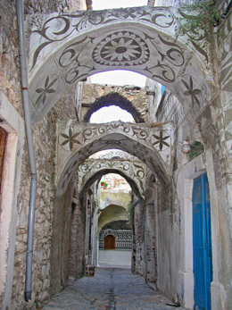
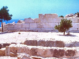
The entire village is 25 Km south of the town of Chios. The village is unique with the black and white geometrical decor of the outer walls of the houses, with its narrow roads, the innumerable churches and amongst them the 13th century Byzantine church of St. Apostles.
It has been designated a listed monument. It is built like a fortress for protection against the frequent attacks by pirates and Turks. It lies in valley far from the sea. The grey stone houses had doors and windows that faced only the interior of the fortress wall.
At the center of Pyrgi rises the defense tower, where the inhabitants took refuge in the case of attack. The streets of the village, which are cobbled and narrow, are connected to the central tower square. At frequent intervals there are transverse archways supporting the structures, as well as vaults and arches supporting the rooms. The functional character of the houses was geared to defense and thus the inhabitants were able to move about the roofs without being seen.
Mavra Volia
(5 Km. from Pyrgi) is a beach with small black pebbles which came from the volcano exploding. There are three beaches, one next to the other, under the same name, with deep, dark blue waters. There are apartments and studios, cafes and taverns offering fresh seafood.
Olympoi
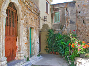
Olympoi is a 14th century medieval village located 31 Km south of the town of Chios and 6 Km far from Pyrgi on the road to Mesta. It has been designated a listed monument. It keeps its houses tied tightly together in what seems like a closed and compact form. The streets are cobbled and narrow.
This type of fortress, a four-cornered structure, was built for protection against the frequent attacks by pirates and Turks. The medieval villages of Chios were built on a fixed plan which may have been imposed by the Genoese.

Mesta
It is a perfectly preserved village-castle 35 Km southwest of Chios town of the Byzantine period It has been designated a listed monument.
The Castle-village, takes you back centuries, with its very few changes. It keeps its houses tied tightly together in what seems like a closed and compact form. This type of village was built for protection against the frequent attacks by pirates. All the houses are connected and if you go to one roof you can walk throughout the whole village from one roof to another. Even most alleys are covered with arches.
It lies in small, treeless valleys far from the sea. The grey stone houses had low doors and narrow windows that faced only the interior of the fortress wall. Visiting this village and walking in its narrow alleys is a lifetime experience.
The harbor of Mesta “Limenas” is at a distance of 4 km from the village.
Kalamoti
is about 20.5 Km south of Chios town. It is a traditional village with two storey stone houses and beautiful carved doors. The village has approximately 850 inhabitants, mostly mastic cultivators.
Komi is located 4 Km outside the village of Kalamoti and is among the loveliest beaches of Chios, with a fine sand suitable for beach games and relaxing sunbathing. The area has many hotels, apartments, rooms to let, restaurants, taverns offering fresh seafood, and bars for evening (or allday) fun.
Katarraktis
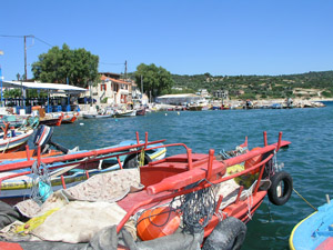
is a seaside village, 16 km south of Chios, with a small beautiful port for trawlers and small fishing boats.
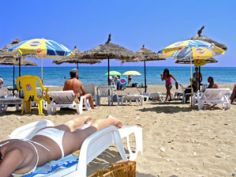
The village has a nice beach and a lot of taverns serving fresh sea-food.
The old Katarraktis village was built 2 Km southwest form the new one. It is now abandoned, though it attracts the interest of many historians for its ruined medieval houses and Byzantine churches.
North Chios
Vrondados
A seaside town situated among olive trees, gardens, almond trees and many other fruit-bearing trees is located 4 kilometers north of Chios town and in the East of mount Aipos. It has 4.500 people most of whom are excellent seamen, merchants and scientists. In the revolution of 1821 they offered a lot to the Greek Fleet.
Today, there are still ship owners who honour the Chian and Grecian Navy, with their merchant ships. According to some historical elements , Christopher Columbus, visited Vrondados in order to study Nautical charts and get information of experienced seamen who would help him to his great voyage for the discovery of America. Three windmills overlooking the bay area are worth seeing.
On the far side of the Vrondados harbor is the Petra Omirou (Homer’s Stone), a natural rock throne where the poet is said to have sung and taught.
Pantoukios
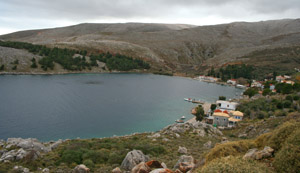
At the northeastern part of the island. It is a small village at a picturesque bay, close to Sykiada.
Most of the inhabitans live there only during summer and they move to Sykiada in winter.
There is a sea food tavern in the area, but there is not a nice beach to swim.
Lagada
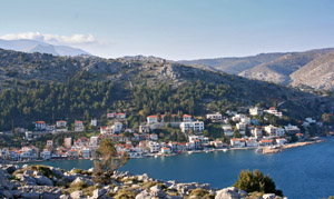
At a distance of 16 km Northwest from the town of Chios, the visitor will find the picturesque village of Lagada. It is a village which descended from the ancient settlements Koila and Kidianda.
Due to the constant attacks on the area, the inhabitants who are mainly merchant marines and fishers.
At Lagada the visitor can rent a room or apartment, and enjoy the traditional sea-food at the restaurants and taverns, which are along the sea side.
Kardamyla
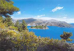
is located at a distance of 28 km North of the town of Chios. It is divided into two sections. The upper section is also the older village, near the hill called “Mount Grias”. The village has traditional architecture, narrow streets, cobblestone alleys and most of the houses are built using stones. Kardamyla is home to approximately 2000 inhabitants in both settlements. Ancient Kardamyla is described by ancient Philosopher Thucydides.
The lower village, called Marmaro, 2 Km from the upper village, is built in the inner part of the bay, protected by the small island called Nisi. Many beautiful mansions are built there by many seamen and ship-owners of local origin.
A distinguishing mark of Marmaro is the statue of the Sailor from Kardamyla, set in the harbor square. Walking in the narrow streets of Marmaro is a pleasant experience that will make one feel the typical island atmosphere of Chios.
The beach of Nagos is 5 km from Kardamyla. The running water springs, the platans and the wonderful beach with colorful small pebbles, all these are features which form the enchanting landscape of the area.
Next bay is Giosonas. A picturesque pebbled beach that spreads out to become one with the waves of the Aegean sea.
Villages in North and northwest Chios are small and located away from the sea.
At the foothill of Pelinneon in a beautiful green environment the small village of Kipouries (37 Km from the town) has become known for its full stone square, characteristic of the village
Kourounia (59 Km from the town) is known for the special variety of wine that is produced here. A variety similar to the one produced in ancient times, called “Ariousios”. An important museum with old icons established recently in the old building of the school.
Volissos
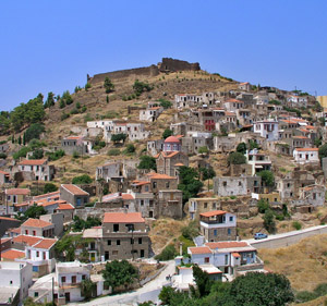
is located Northwest, about 40km away from the capital of the island and has a long history.
At Volissos, according to Thucydides, there was once an ancient Aeolic city, and the rumor that it was the birthplace of Homer is still a legend told.
On the top of the hill was built a castle in the medieval times. The Byzantine castle has a trapezoid shape with six circular towers. Inside the castle, there were several buildings, cisterns and churches. There was also a tunnel connecting the castle with the seashore and the Pithonas district.
Volissos is the biggest village in NW Chios mountainous area – and it’s the capital of Municipality of Amani.
Managros,Magemena, Gonia, Limnia (the port which is connected by boat with Psara island), Lefkathia, Limnos, Lampsa, Aghia Marcella, are the beaches near the village in the blue Aegean Sea.
In a short way from Volissos there is the pilgrimage of the local Saint “Aghia Marcella”. On July 22nd, thousands of worshipers coming from all over the island and the country are gathered to celebrate. Holly water springs from a hole just beside the cold sea.
Aghio Galas
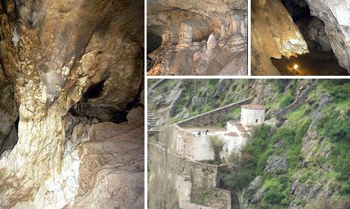
69 Km from the town, is built at the northwestern part of Chios island on a rocky mountain. Unique caves extend below the present village, a complex of at least three chambers, the largest of which is approximately 200 meters.
People settled in this cave during the Early Neolithic period (6000 – 5000 BC) and lived until circa 2700 BC. Fragments of clay objects, as well as animal bones, indicate that the cave was also used as a sanctuary from Archaic to Roman times. Since the Byzantine era to the present day it has served as a place of Christian worship, consecrated to Panagia Aghiogalousaina (Virgin of the Holy Milk).
Agio Galas village in North west Chios
There is also a tiny chapel of St. Anne within the cave.
The village’s name came after “the milky water” (gala=milk) dropping from the stalactites of the cave.
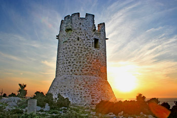
Viglas,
also called Friktories, were watchtowers important to the system of defense of the island from the early 11th up to early 19th century AD. They are cylindrical buildings, 12 to 20 m. high, with a 15m. diameter. If the watchman (Viglatoras) had seen an enemy ship he was notifying other Viglas (and eventually the village) by lighting up a fire at night or by smoke signals during the day, so that the villagers had the time to prepare their defense.
Viglas had no gates or any other entering point! The watchman, had to throw a rope with a cramp and climb up in order to enter the Vigla. By having no doors, and therefore a point of entry in the vigla even lightly armed watchmen could successfully rebut any attack. (usually by pirates)
There were about 50 Viglas on Chios island. They were built in strategic places and fully covered the views of the bays that an enemy ship could approach the island as well as the open sea. From the top of each Vigla the watchman (Viglatoras) could clearly see the next two Vigles, one of each side. The Viglas at the northern part of the island are almost destroyed, but they are very well preserved at the south and especially at the Southwest part of the island.
In the Chios District (Prefecture) also belong the following small islands:
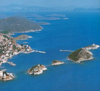
Oinouses
A small group of islands, known from ancient times for their famous wines. Genoans, during the Middle Ages, called them Spermandores. Later in the middle of 17th cent. it was colonized by shepherds from the Chian village of Kardamyla, being full of goats and it was called Aegnousa. Since the middle of 19th cent., the inhabitants, working in the sea, became ship-owners and today they own more than 500 ships, various members of the Livanos, Lemos and Pateras families were born here. Therefore Oinousses are considered the richest island all over the world.
Two church-tipped islets, each privately owned, guard the unusually well-protected harbor; the town of Oinousses is surprisingly large, draped over hillsides enclosing a ravine. The houses displaying a mix of local and modest Neoclassical style.
The rest of this tranquil island, at least the southern slope, is surprisingly green and well tended; there are no springs, so water comes from a mix of fresh and brackish wells, as well as a reservoir. The sea is extreme]y clean and calm on the sheltered southerly shore; among its beaches, choose from Zepaga, Bilali, or Kastro, respectively five, twenty and thirty minutes’ walk west of the port.
Psara
Close to the northwestern part of Chios is the island of Psara. The birthplace of revolutionary war hero Admiral Kanaris, as well as of other significant heroes of the war of Independence. Psara devoted its merchant fleets -the third largest in 1820s Greece after those of Hydra and Spetses -to the cause of independence, and paid dearly for it. In 1824 the Turks landed overwhelming forces to stamp out this nest of resistance. About 3000 of the 30,000 inhabitants escaped in small boats which were rescued by a French fleet, but the majority retreated to a hilltop powder magazine and blew themselves up rather than surrender.
Psara never recovered from the holocaust.
Psara Small island North West of Chios Island
The Turks burned whatever houses and vegetation the blast had missed. Today the permanent population barely exceeds four hundred residents. In 1980s a revitalization project was instigated by a French-Greek descendant of Kanaris and a Greek team. The port was improved, mains electricity and pure water provided, a secondary school opened and cu1tural links between France and the island established, though, so far, this has not been reflected in increased tourist numbers
